Multnomah County Sheriff’s Office River Patrol Unit and Partner Agencies Address Safety Concerns Along Sandy River
Published
MULTNOMAH COUNTY, Ore. (May 20, 2026) – The Multnomah County Sheriff’s Office River Patrol Unit is providing an update to its ongoing Sandy River safety advisory.
Earlier this month, the Multnomah County Sheriff’s Office warned the public about numerous hazards, including a collection of fallen logs and a newly formed large sandbar, reported on the Sandy River between Oxbow Regional Park and Dabney State Recreation Area following a severe winter storm.
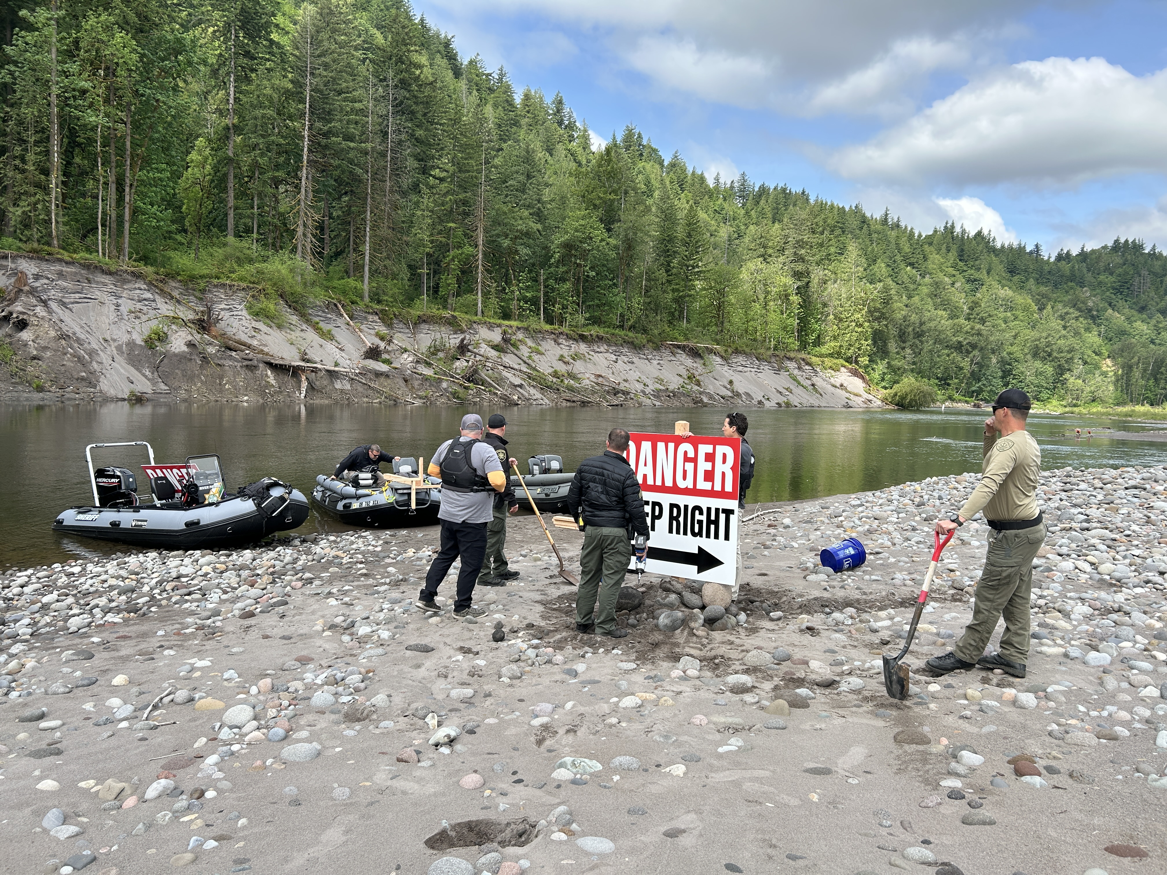
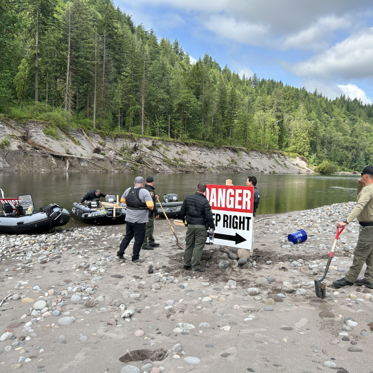
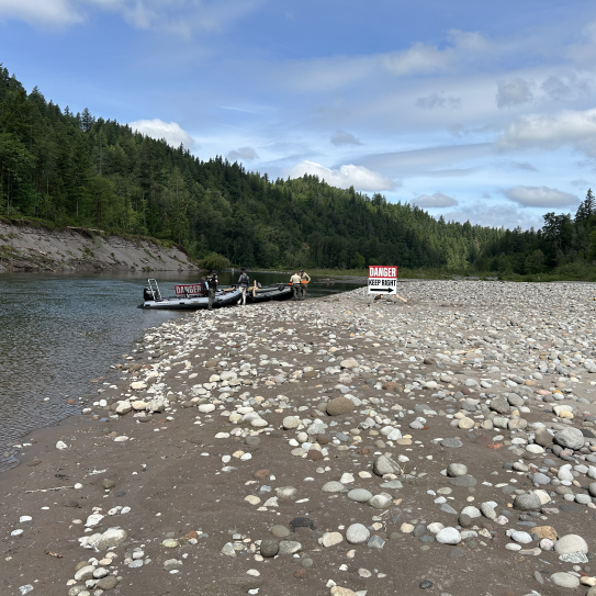
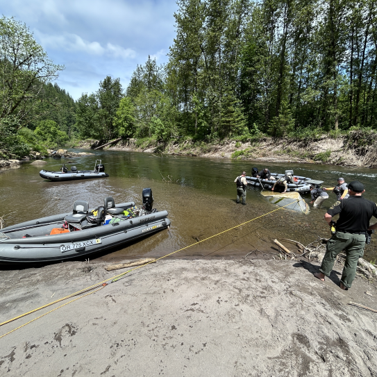
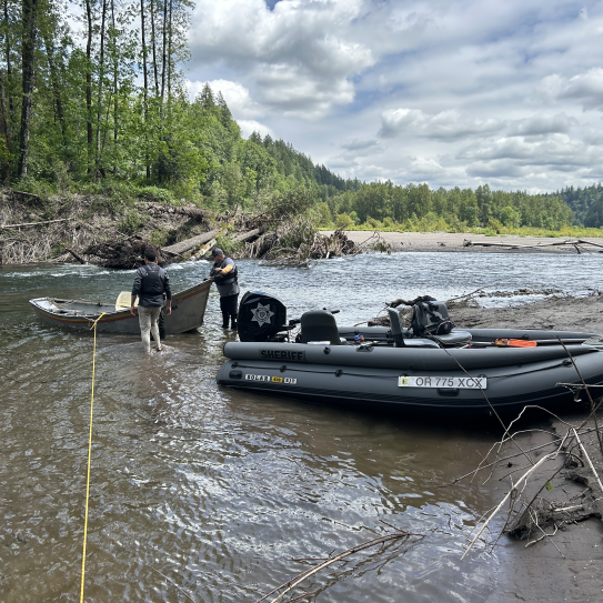
On Tuesday, May 19, 2026, the Oregon State Marine Board, Multnomah County Sheriff’s Office, Washington County Sheriff’s Office, and Clackamas County Sheriff’s Office installed two large “Danger, Stay Right” signs upstream of the hazard area. These signs are intended to give river users advance warning of the shifted current and debris field created by a December 2025 storm.
In addition to signage installation, deputies and partner agencies recovered a submerged drift boat that had become lodged in the debris. The vessel will be returned to its owner if they are identified. An unusable kayak, damaged beyond repair, was also recovered.
The Multnomah County Sheriff’s Office continues to urge river users to exercise heightened caution. As outlined in the original warning, the river’s primary channel has shifted to the west side of a wooded island south of Camp Angelos, where newly formed “strainers” and submerged hazards are creating dangerous conditions, including small rapids and strong pull toward debris.
Recreational users should remain vigilant, wear lifejackets, avoid relying on outdated satellite imagery or GPS mapping, and be prepared for rapidly changing river conditions.
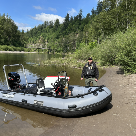
To provide a visualization, the Multnomah County Sheriff’s Office is releasing photographs of the affected area and new signage, which were taken May 19, 2026.
Recent Press Releases
- Published:
- Published:
- Published: